


-
Start
-
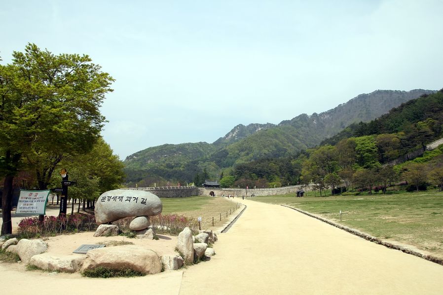
Mungyeongsaejae
-
Mungyeongsaejae Filming Site
-
Museum of Old Roads
-
Natural Recreation Forest
-
Trekking-1
-
Trekking-2
-
Gaeun filming site
-
Coal Museum
-
Guryangri Rail Bike
-
Finish
A survey has recently been conducted on the '100 tour sites Koreans should visit' among the Korean people by Korea Tourism Organization and honorably, Mungyeongsaejae won the first place.
It is an old path connecting Mungyeong, Gyeongsangbuk-do and Chungju, Chungcheongbuk-do, and there was no other way around but passing through this path in order to get to Hanyang from Jeollado or Gyeongsangdo. Plus, it has so many tourist attractions in Mungyeong that I cannot go through the list here but to name a few, there are Museum of Old Roads, KBS Filming Site, Coal Museum, Rail Bike, and SeokyuDongcheonNadeulgil tacking courses. I am going to walk you through my 2-day trip.
Right, my journal is written based on the timeline since I figured some of visitors would travel the city as I did, and I suggest that you should pack snacks in breaks since you have to walk quite long hours.
Oh, don't forget to wear comfortable shoes for walking. It would be really helpful if you have climbing sticks. For your information, I drove a car to move between places starting from Gyeonggi-do. Okay, then, shall we start to look at Mungyeong?
Mungyeongsaejae selected as the first tourist attraction that Koreans should visit 문경새재
It takes 1 and a half hours from Gyeonggi-do through Gyeongbu Expressway → Pyeongtaek-Jecheon Expressway→ Sanggyeongro → Jungburo to finally get to Mungyeongsaejae Provicial Park by car.
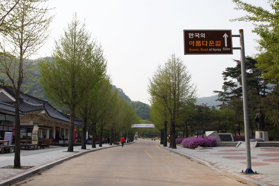
Address: 288-1, Sangcho-ri, Mungyeong-eup, Mungyeong-si, Gyeongsangbuk-do (경상북도 문경시 문경읍 상초리 288-1)
Telephone: 054-571-0709
As one of The Most Beautiful 100 Roads in Korea, this road reflects the old people's tiring lives and was the shortest route between Seoul and Busan since Goryeo Dynasty era.
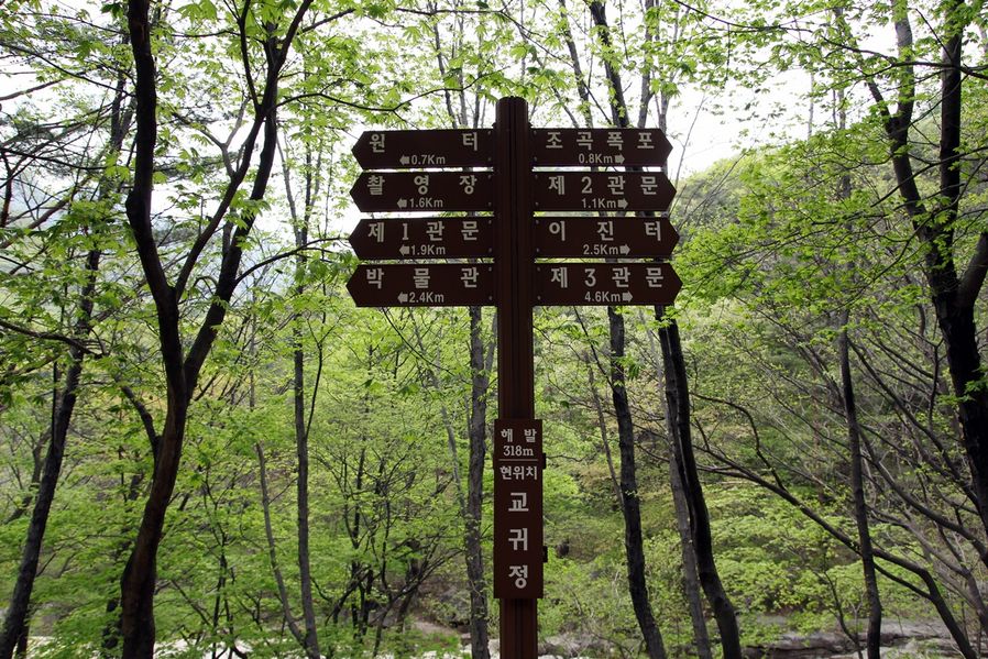
There are three gateways to this old road. Today, I am going to walk you through the entrance to Gateway No.1 and to Gateway No.2. Total distance would be 9.6km including 1km from the entrance to Gateway No.1, 3km from Gateway No.1 to Gateway No.2, 1.6km to go and come back from Yeogung Falls along the trail.
Plus, there is a filming site and Museum of Old Roads to look around so you would have to walk about 11-12km.
For those who would go to Gateway No.3, you need to walk 7km (3.5km for one way) more so it would be an exhausting trip than you think. Therefore, if you have a car, I would recommend you to take a round-trip to Gateway No.2 course.
For those who would go to Gateway No.3, you need to walk 7km (3.5km for one way) more so it would be an exhausting trip than you think. Therefore, if you have a car, I would recommend you to take a round-trip to Gateway No.2 course.
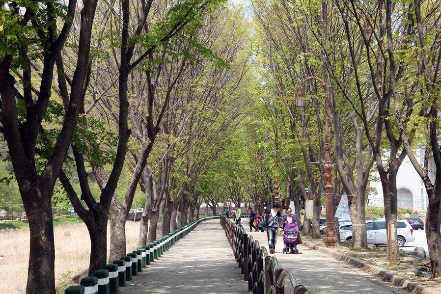
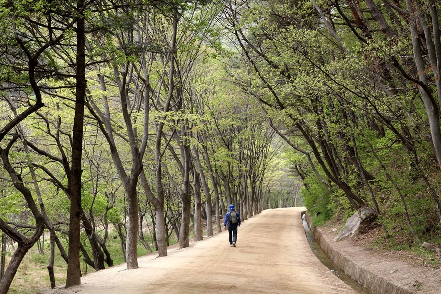
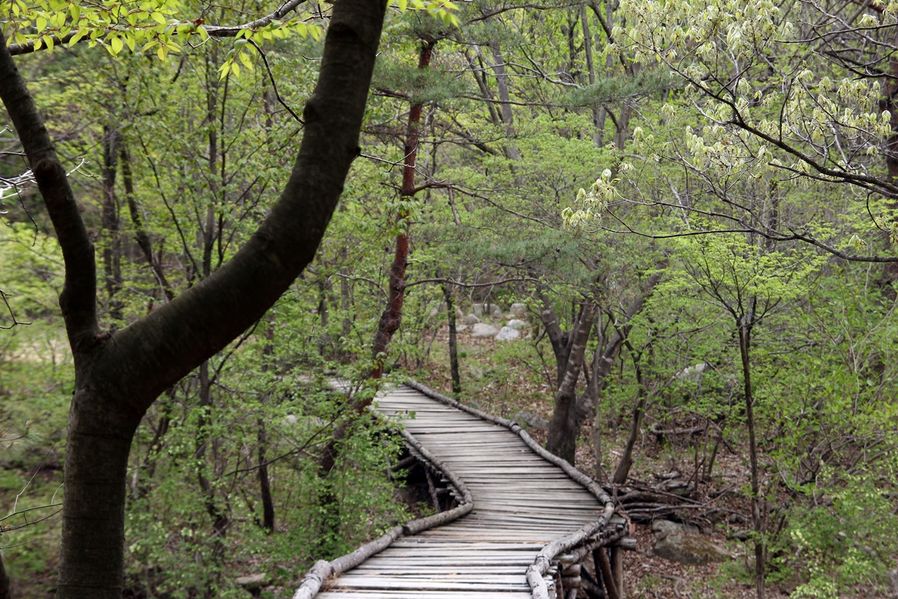
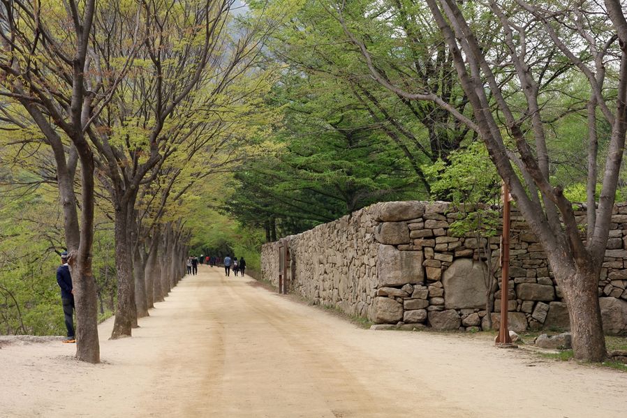
The weather is perfect for walking in spring and autumn in Korea. It wasn't hot or cold on the day I visited so I could enjoy a pleasant walk. If you look at the road from the entrance, there are wooden decks across the stream on the left and there is an old dirt road on the right.
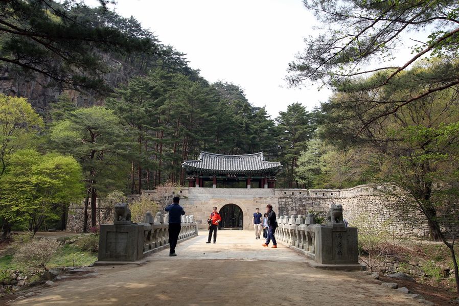
If you walk along the road about 1km from the parking lot, you will see Gateway No.1. It looks so beautiful with a high mountain in the background.
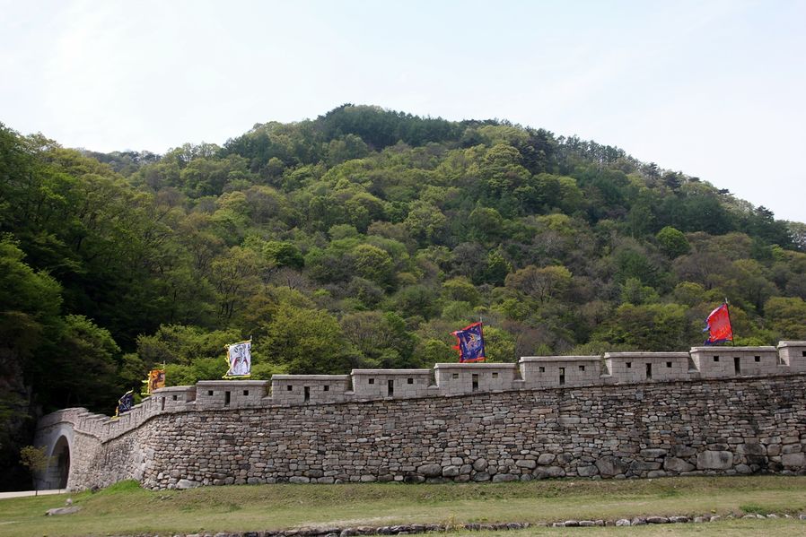
Look at the stones that build the castle. Each stone has different sizes and shapes and they made the walls so dense and strong like this. I am really amazed by the techniques of our ancestors.
Look at the stones that build the castle. Each stone has different sizes and shapes and they made the walls so dense and strong like this. I am really amazed by the techniques of our ancestors.
Named after female body shape 'YeoGung Falls' 여궁폭포
You can see a trail on the right as soon as you enter Gateway No.1.
Walk along the trail about 800m, then, you will see Yeogung Falls right before you get to Hyeguksa Temple.
They say it is located 800m high but the mountain is quite steep so you won't find it that easy. So I wouldn't recommend you this course if your shoes are uncomfortable or your legs hurt. I went anyway because I still had things to introduce to you.
Address: San 35, Sangcho-ri, Mungyeong-eup, Mungyeong-si, Gyeongsangbuk-do, Korea (경상북도 문경시 문경읍 상초리 산35)
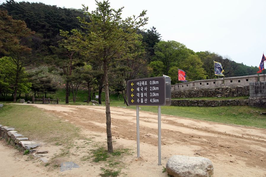
When you walk pass Gateway No.1, you can see a sign that says it is 0.8km left to Yeogung Falls.
I took the photo from the opposite side so it seems like the left side, but I say you should go up to the right side after you pass through the Gateway No.1.
You could see the water flowing from Yeogung Falls even from below.
The way up to the falls looks very beautiful so if you have strong legs, I say, go for it. There are few people who are willing to climb this steep trail so you could walk like you are on a date enjoying quietness and calm atmosphere.
I could constantly see water flowing but I didn't hear any sound of waterfalls. It must be small waterfall hidden somewhere!
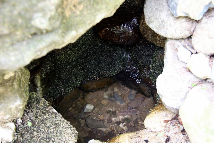
This is a small mineral spring that we met on our way. The water was not officially tested but I doubt it is contaminated when it is hidden in this lonesome place. So we took little sips and kept going up.
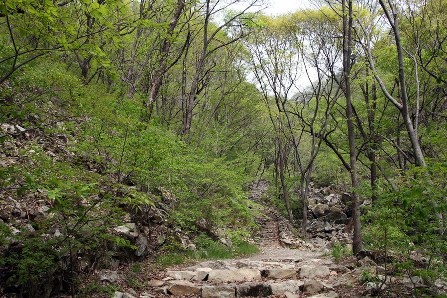
The paved road ends here and it leads to stone steps and unpaved road. The path is very steep so it would be hard to walk. Take your time.
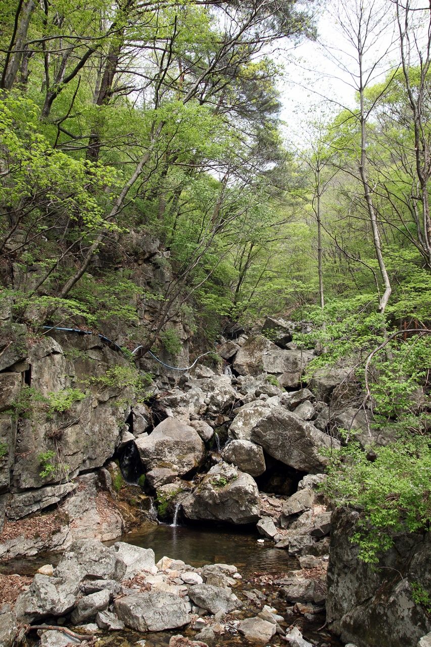
I believe we walked almost 800m but I still couldn't hear waterfalls. Is it because it has not rained recently in Korea so the waterfall may be dried up? I feel anxious suddenly.
It was easier to walk when we got closer to the falls since wooden decks were built. That place that looks like a viaduct must be the falls. Finally, I hear the sound of waterfall.
Yay! The water hasn't dried up. It is not a big fall but still it flows down loudly. It was so worth all the sweat to come up here. It was so cool and beautiful.
The waterfall dropping between 20m high rocks looks like crystal. Yeogung Falls was named after female body shape and it is also known as Yeosim Falls. People who live nearby call it Parangso, which has a story that an angel comes down here to take a bath passed down to new generations.
Yay! The water hasn't dried up. It is not a big fall but still it flows down loudly. It was so worth all the sweat to come up here. It was so cool and beautiful.
The waterfall dropping between 20m high rocks looks like crystal. Yeogung Falls was named after female body shape and it is also known as Yeosim Falls.
People who live nearby call it Parangso, which has a story that an angel comes down here to take a bath passed down to new generations.
When I look behind after I get to the fall, I get the view like this.
The wooden decks on the left are the road I walked up and you will see Hyeguksa Temple if you walk 200m to the right from where I am standing.
Hyeguksa Temple was not included in my plan so I passed.
I walked down about 800m from Yeogung Falls until I get to Gateway No.1. Now, I walk along the right path that leads to Gateway No.2.
Again towards the Gateway No.2 through the old road of Mungyeongsaejae…
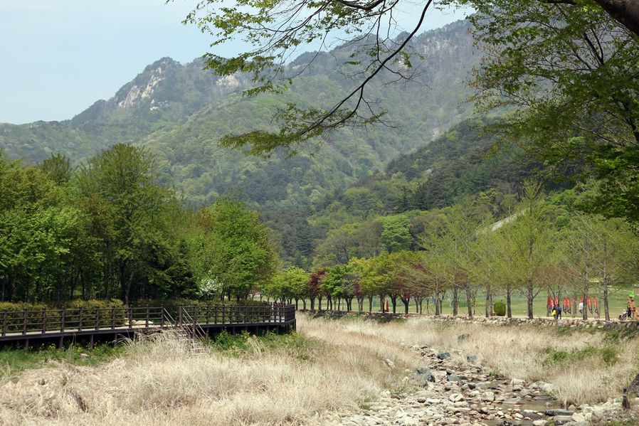
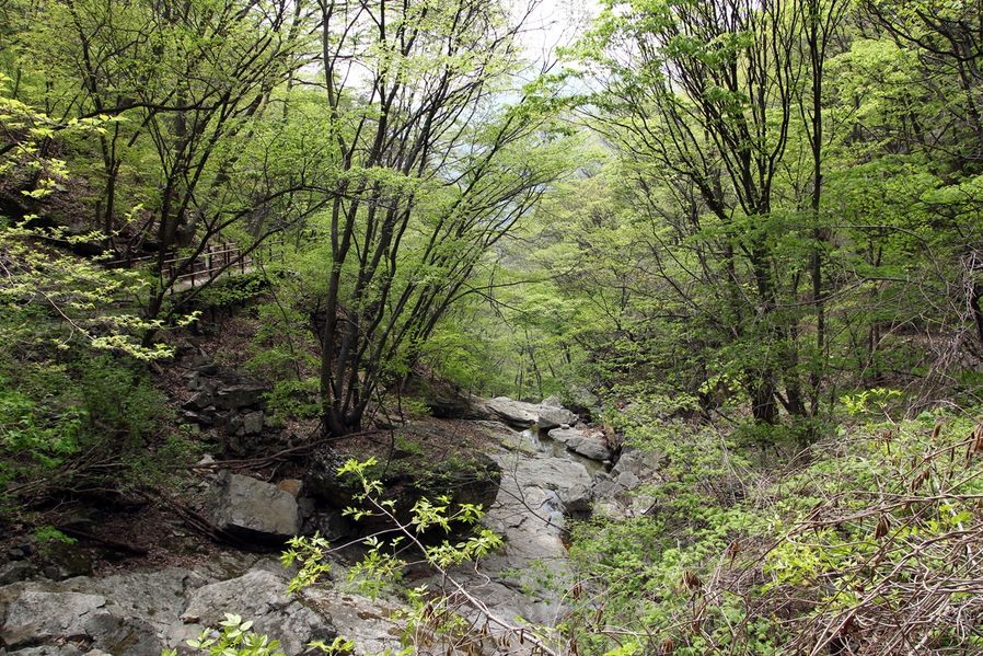
The distance between Gateway No.1 and Gateway No.2 is about 3km. I hope you are not exhausted yet after merely walking 1.6km distance. Take your time to get to Gateway No.2 since it is close that even kids would walk there.
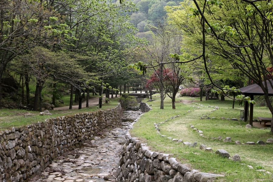
I am not sure if you can see in the photo that the road is almost flat but slightly up to Gateway No.2. There is a small stream that looks like agricultural waterway on the right side of the road and you could constantly hear the water from big brook on your left. You must feel so fresh.
I am not sure if you can see in the photo that the road is almost flat but slightly up to Gateway No.2.
There is a small stream that looks like agricultural waterway on the right side of the road and you could constantly hear the water from big brook on your left. You must feel so fresh.
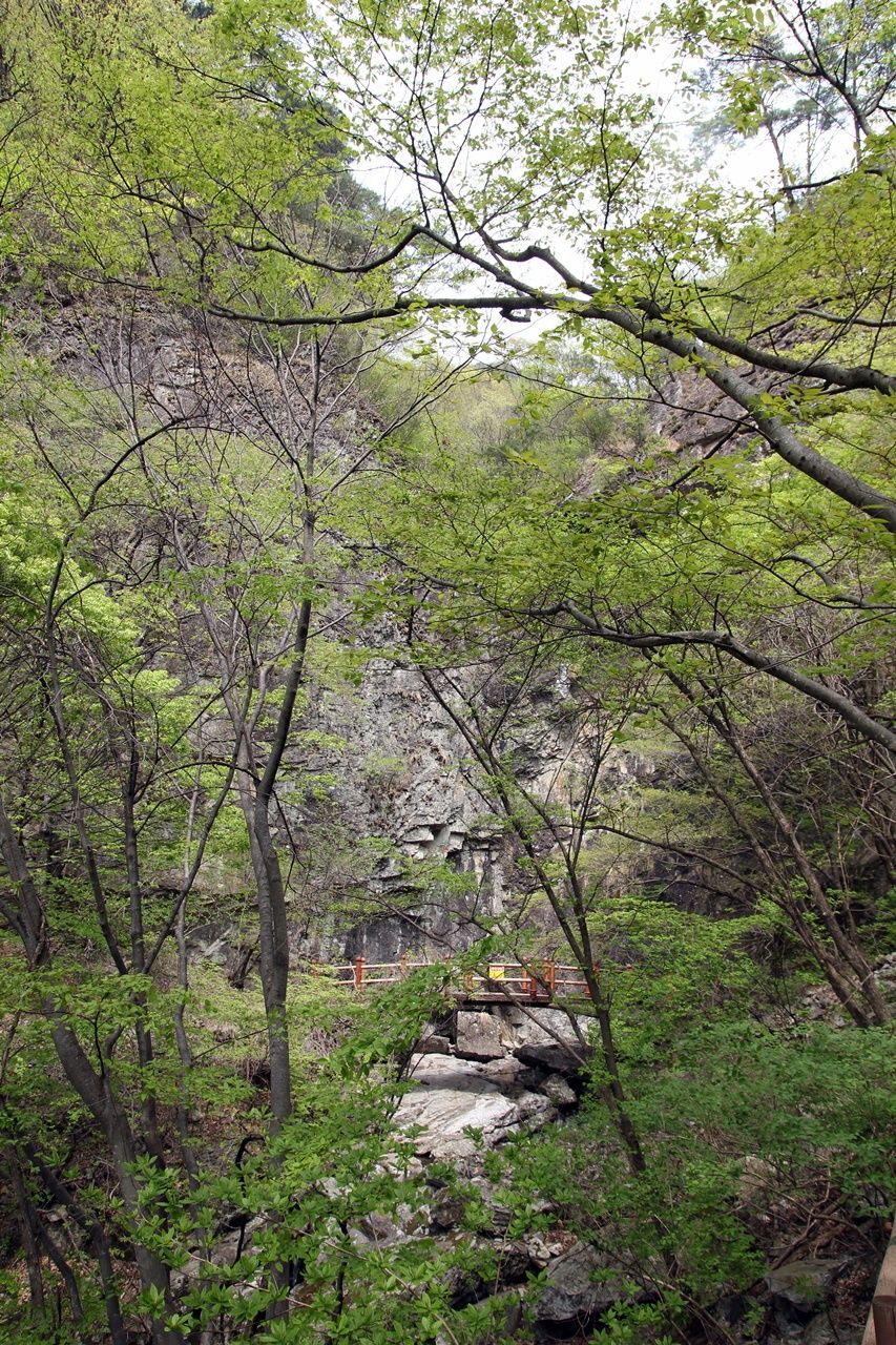
We were not allowed to get in there probably because the bridge is danger of collapse. I wonder what is there at the end of that bridge.
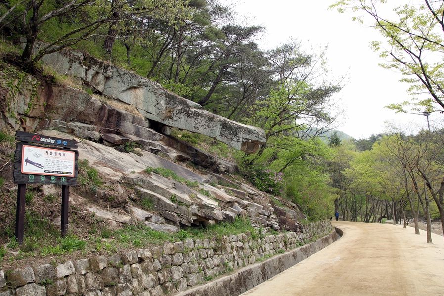
Walking along this road, there are things to see on your left and right constantly and one of them is this rock called 'Jireumteulbau.' Gireum (oil) is called Jireum in Gyeongsang-do, and it was named after the look of cast that squeezes oil. Quite a view made by nature itself, isn't it?
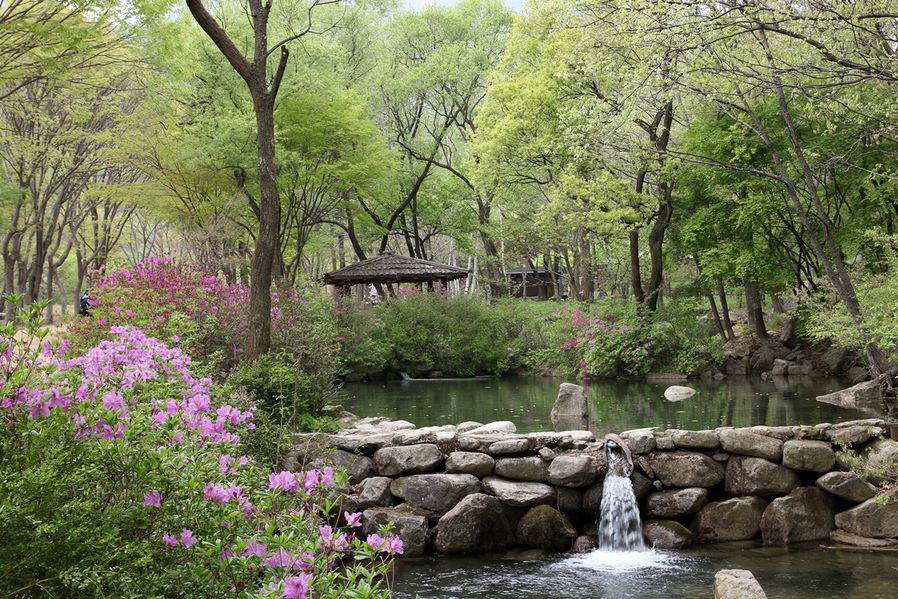
There are things to see both sides along the road that make us not to be bored.
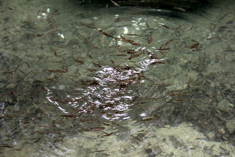
In the pond, there were small fish and they gathered for Bushman bread crumbs that I brought for my dessert. :)
If you keep walking along the path in the forest, you can see 'Joryeongwonteo(鳥嶺院址)' on your right. Won(院) indicates a facility that provided meals to government officials who were on a business trip to other regions and it was operated since Goryeo to Joseon Dynasty era.
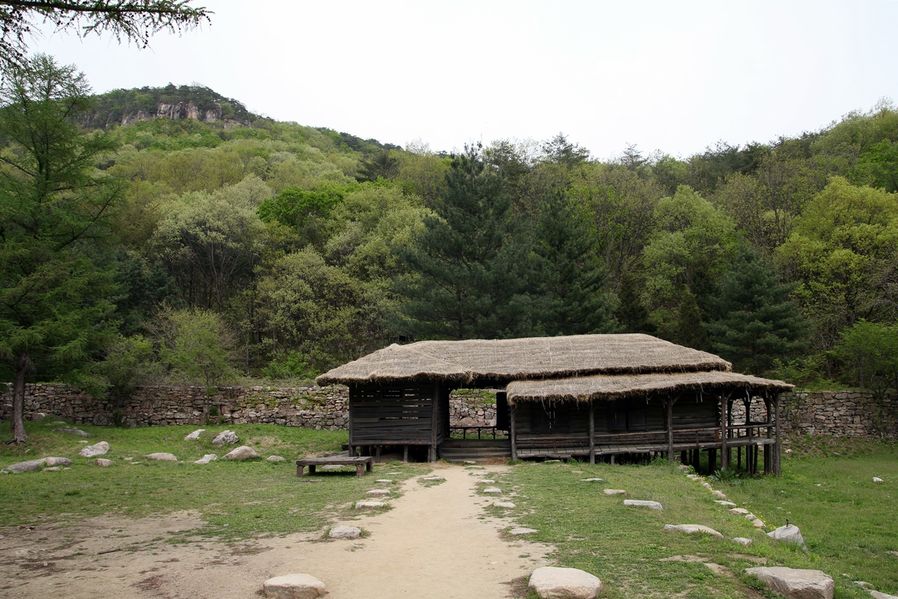
There is nothing inside the Joryeongwonteo, only the ground of the house remains. The building in the photo temporarily reconstructed the original building. The castle walls with big and small square stones look very unique.
The stones are built up outside and look step-like inside which I assume would have been used as castle walls in old times.
It was quite boring to walk back the same path so I headed to the old way.
This path has recently been expanded widely but in fact, this path led to Hanyang in old times.
We could easily step on overlapped section of old road and new road.
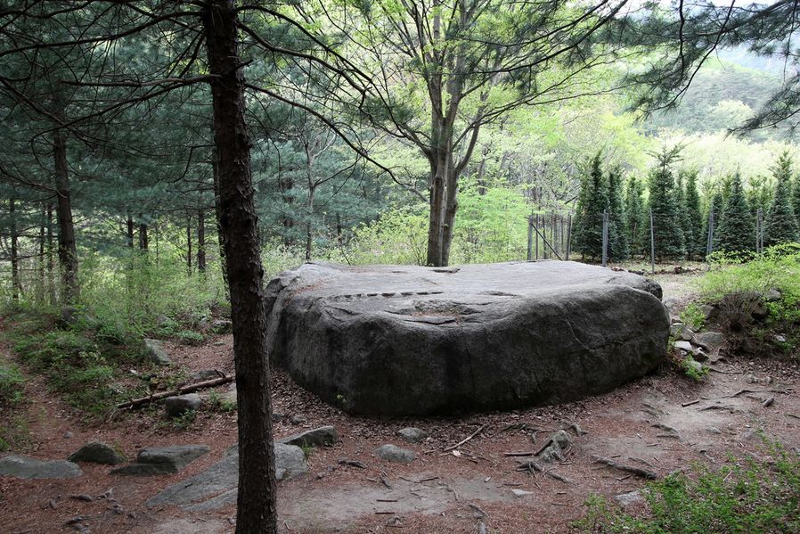
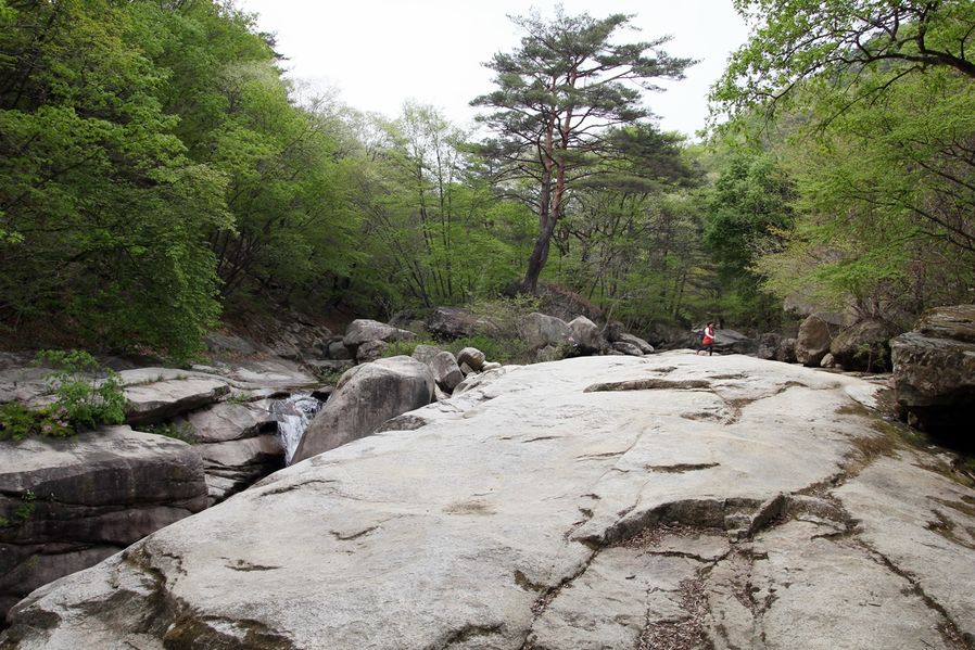
I found a very wide rock as I was walking along the path. In old times, thieves hidden behind this big rock often ambushed scholars who were going to civil service examinations to Hanyang.
I guess there are always bad in all ages.
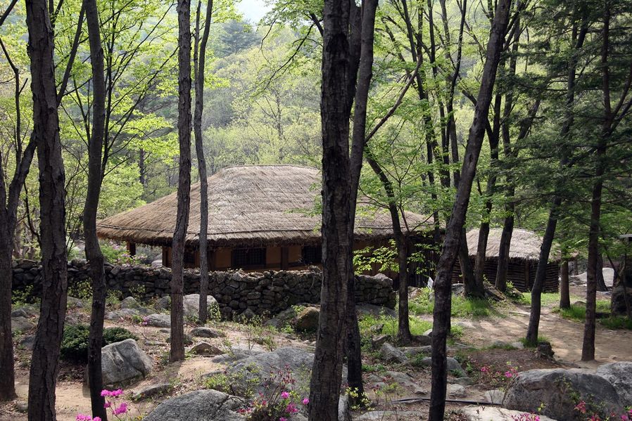
I see thatched-roof house by the side of the path as I was about to get to the middle point between Gateway No.1 and Gateway No.2.
It says there used to be an inn in Joseon Dynasty era. The thatched-roof house surrounded by stone walls looks friendly.
I believe this used to be crowded with classical scholars who were going for civil service exams, peddlers or people who were visiting their relatives.
I wish I could go there if there is a time machine.
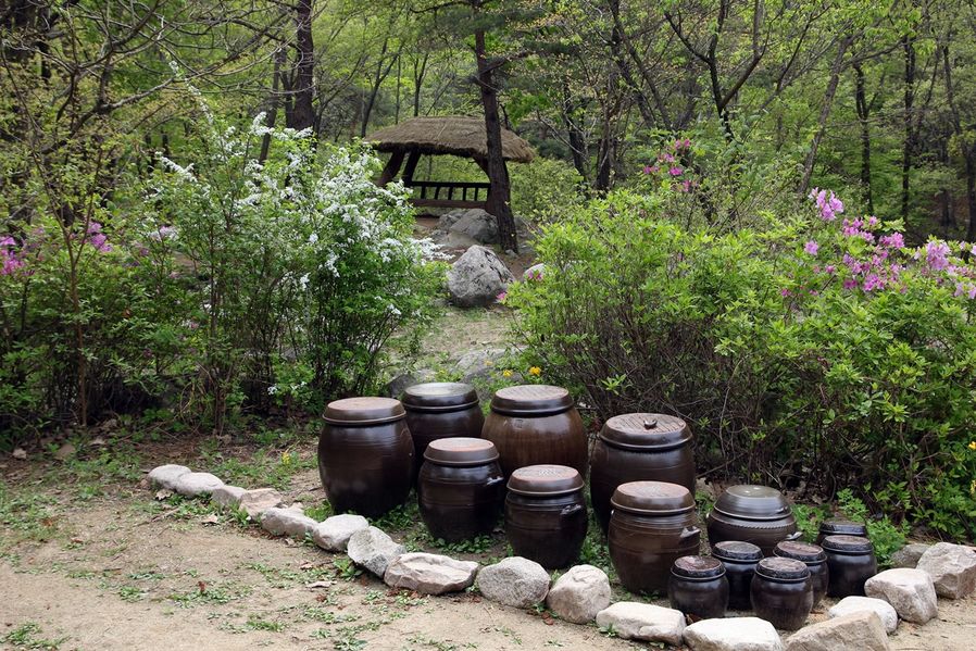
There are pretty Jangdokdae(platform for crocks of sauces and condiments) surrounding royal azalea flower garden in one corner of the yard.
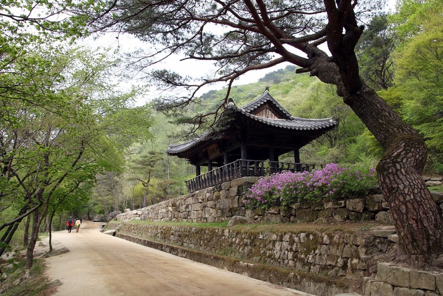
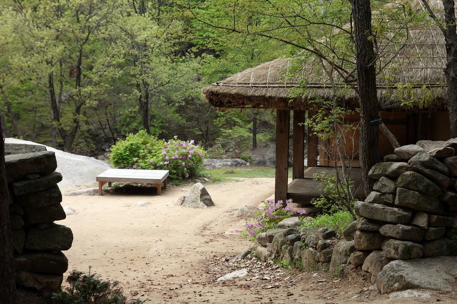
If you go up a little further, you will see a royal palace called Gyoguijeong (交龜亭) on your right.
This is Gyoincheo (交印處) where newly appointed Gyeongsang Provincial Auditor used to transferring his business to its successor. The building was restored later but this is the only one left in Korea.
If you finally get to Gyoguijeong, there's only 1 km left until you see Gateway No.2. So keep it up a little more.
My legs still feel heavy from hiking to Yeogung Falls. This is the wide rock where Gungye died at last scene in the Korean drama titled 'Taejo Wanggeon(Wang-geon, the Great)'. I gotta take a rest for a while.
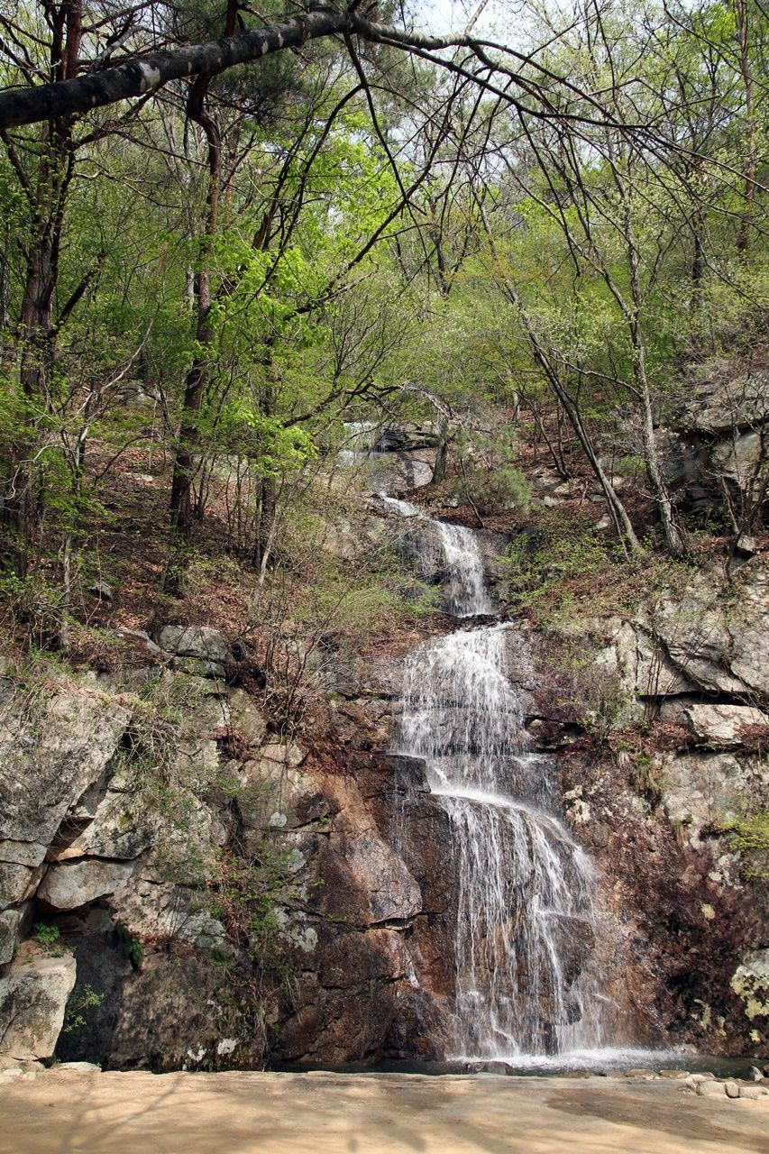
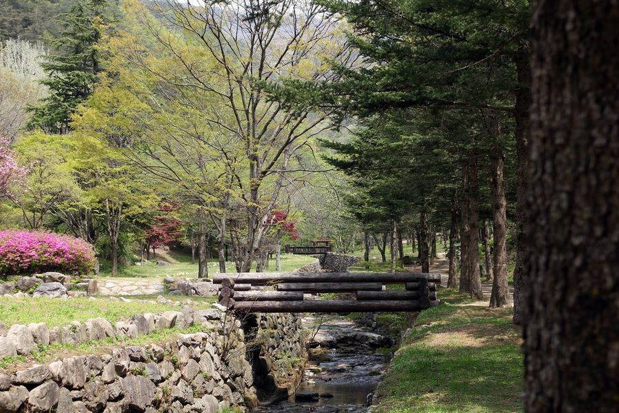
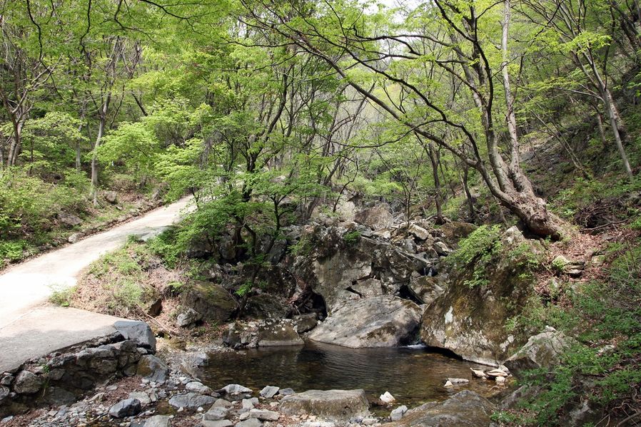
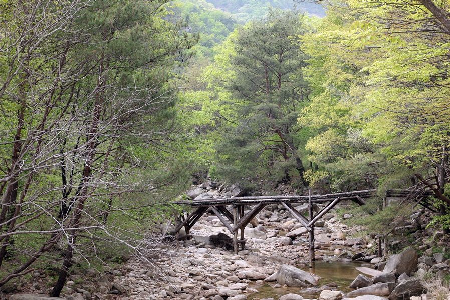
Go up a little from the Gungye rock, there's Jogok Falls flowing loudly on your right. It was a quite hot day and the water was cool enough to cool the high air temperature during the day. Walking by it made me feel fresh.
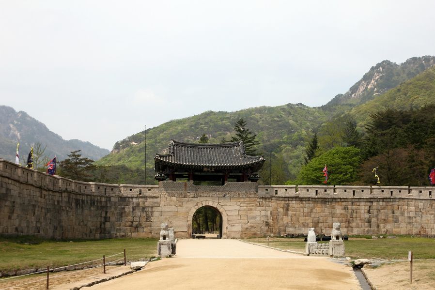
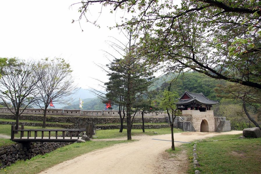
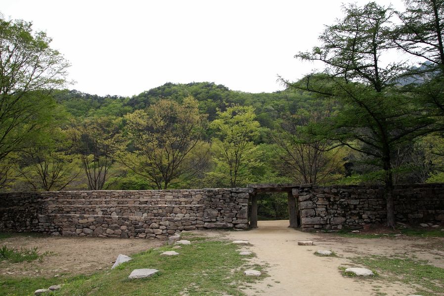
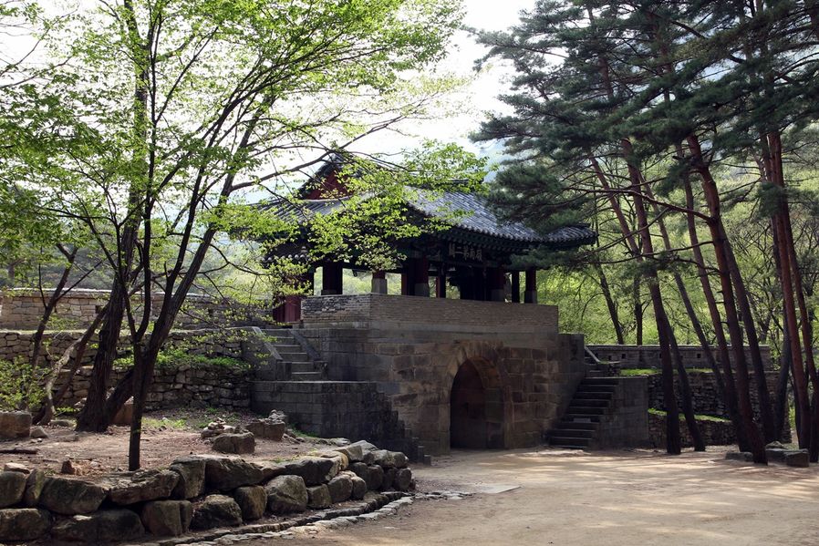
I got to the Gateway No.2 finally. It is so beautiful with red leaves in fall, but I must say that the view with new green leaves budding in spring is quite astonishing.
Tourists are busy with taking photos on the bridge. I find that there are as many foreigners as Koreans in Mungyeong.
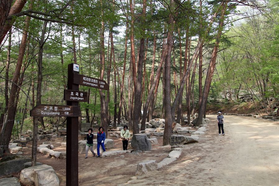
Gateway No.2 is 3.5km away from Gateway No.3 with uphills and downhills and it takes 3 hours to make a round-trip so I don't recommend you this course if you have only 2 days in Mungyeong.
So I am going back to Gateway No.1 from here.
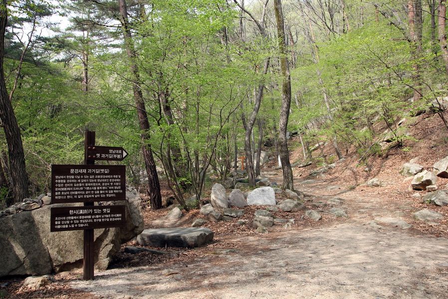
If you visited here for tracking, I think it would also be good to walk along Mungyeongsaejae civil service exam road(old path).
Apart from the fact that you are walking along the path where old people used to, it will give you joy when you find Korean poems written by ancestors from Joseon Dynasty era on the sides of the path.
In the photos above, there are three rocks on which Korean poems are written.
I am turning back from Gateway No.2 and head to Gateway No.1. Try to look at the Gateway and castle walls from behind, then you will know from whom they were trying to protect themselves.
Can you see that it is defending itself against the south? You can see it was built since Japanese invasion of Korea in order to defend itself from enemies marching for the capital city.
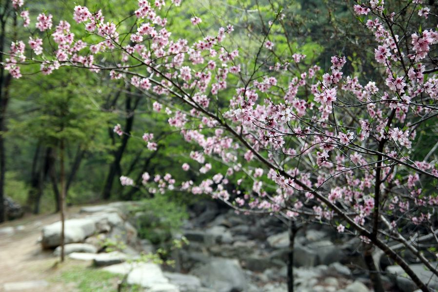
The way back is a slight downhill so it is easy to walk. I can see the flowers now. :)
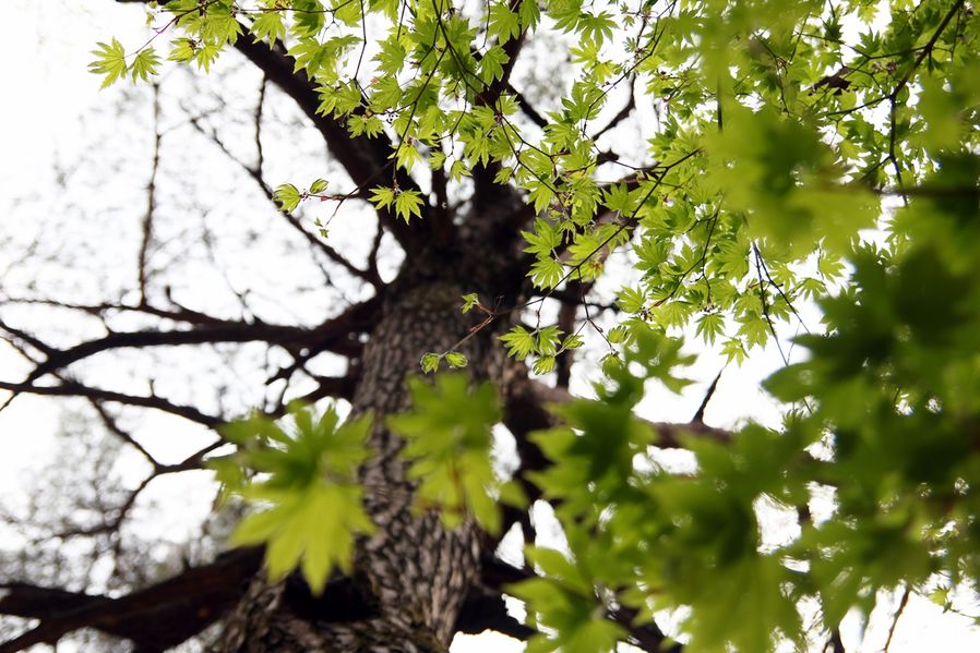
Refreshing colors of leaves on the trees were really amazing. I could feel and smell the nature.
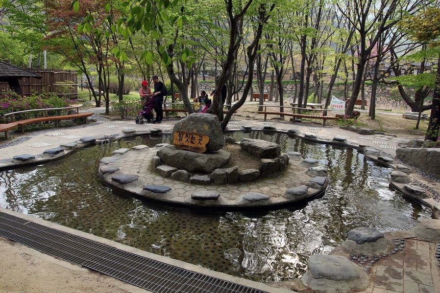
We almost got to Gateway No.1 in no time. There's a filming site that recreates the Joseon Dynasty era near Gateway No.1, so we will get there. Before that, we will take off our socks and wash feet with water prepared for people who finished tracking. It is not stagnating and keeps flowing so the water is always clean.