


Miryang-si is located in the northeast of Gyeongsangnam-do, Korea. Gyeongbu Line(Railroad) and Daegu-Busan Expressway pass by the region. It is located between Daegu Metropolitan City and Busan Metropolitan City. “Milyang Arirang,” is the famous folk song. Regional product is jujube. The city hall seat is Gyodong. The administrative division is 2eup 9myeon 5dong. (Data source: Wikipedia)
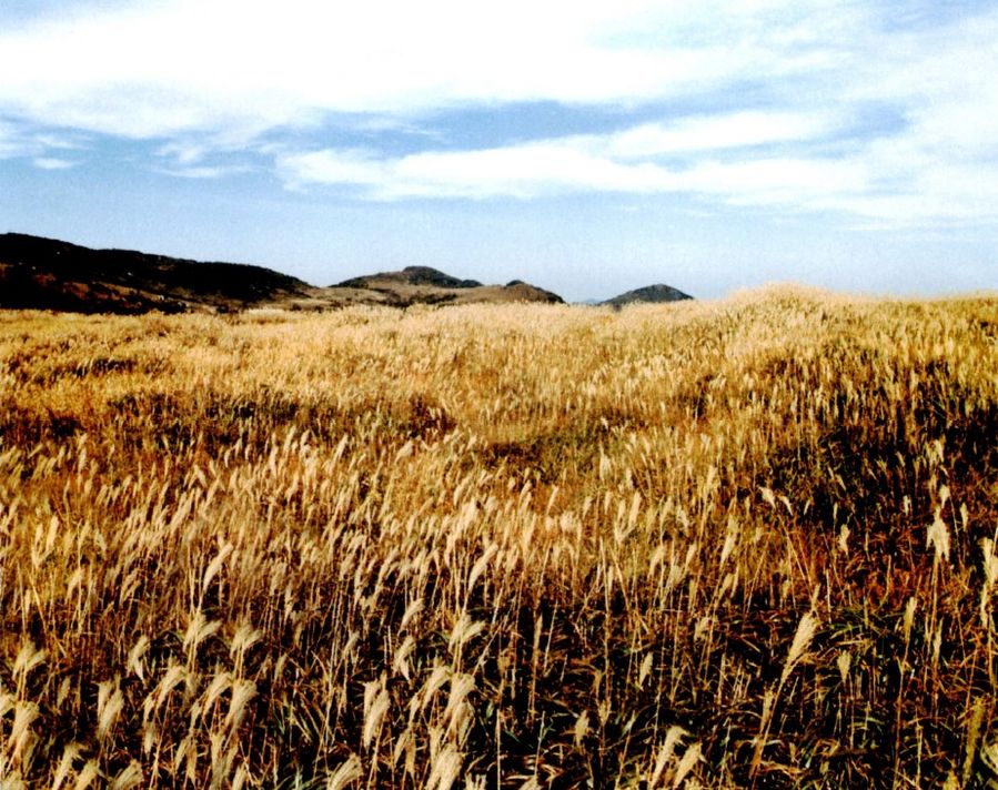
Sajapyeong
Sajapyeong is 2.5 million pyeong of vast plain. It is located between the altitude of 700~800 meters of eight ridge of Jaeakssan mountain, the famous Alps of Yeongnam. In particular, it is famous for brown and silver reeds in fall.
Address: Mountain 1, Danjang-myeon, Miryang-si, Gyeongsangnam-do
Contact information: 055-359-5643
Website: http://tour.miryang.go.kr/
The way to visit: Namyangsan mountain IC→ Underground road way of Yangsan bridge→ Gongdanipgu intersection→ Hyeonchungno→ Eogok regional industrial complex→ Seongnamsa temple→ Baenaegol valley
Yeongnamnu Pavilion
Miryang Yeongnamnu pavilion has been one of the three main pavilions in Korea along with Chokseongnu pavilion of Jinju and Bubyeongnu pavilion of Pyongyang since the Joseon dynasty period. It is located in the cliff of riverside of Miryang, the branch of Nakdonggang river. It has amazing scenery and extraordinary interior style. The night view of it represents eight famous landscapes of Miryang.
Address: Naeil-dong 40, Miryang-si, Gyeongsangnam-do
Contact information: 055-359-5590
Website: http://tour.miryang.go.kr/
The way to visit: NamMiryang IC→ Yerim intersection→ Maam intersection→ Sammun 1ro→ Joongangro
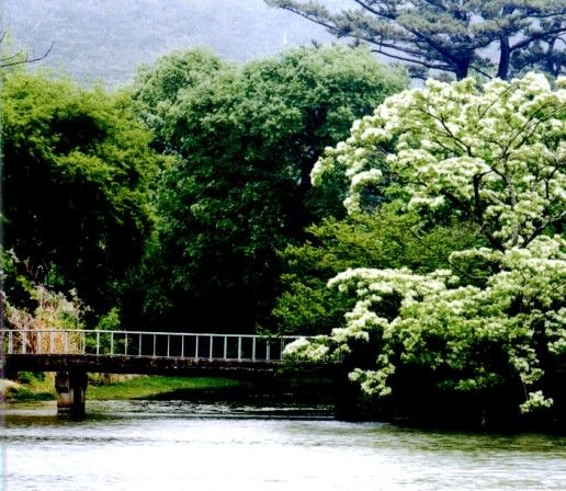
Yuyang Pond
Yuyang pond has the natural beauty. There are five islands in the small reservoir with 166 meters of circumference. The combination of willow and Chionanthus retusa is amazing. On a peaceful day, the landscape reflects in the calm surface of the water.
Address: Wiyang-ri 294(under Hwaaksan mountain), Bubuk-myeon, Miryang-si, Gyeongsangnam-do
The way to visit: NamMiryang IC→ Yerim intersection→ Maam intersection→ Chunwha three-way intersection→ Uiyanggil→ Pyeongbatgil
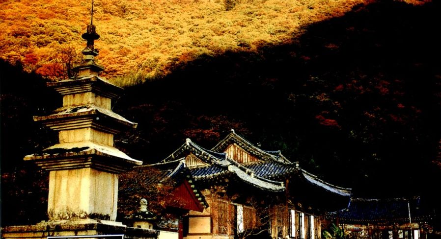
Pyochungsa Temple
Pyochungsa temple is settled among beautiful Gajisan mountain, Unmunsan mountain and Jaeyaksan mountain. It is the historic site for Samyeong Daesa who rescued the country in Japanese Invasion of Korea in 1592. It has cherished a lot of cultural relics like national treasures and important folklore materials.
Address: Gucheon-ri 31-2, Danjang-myeon, Miryang-si, Gyeongsangnam-do
Contact information: 055-352-1150
Website: It is unavailable on 11th, February, 2015
The way to visit: Miryang IC→ Geumgok intersection→ Danjang, Pyochungsa temple
Check Point
Pyochungbi Monument: It has been called sweating monument. It is because some water drops form on the surface before and after big disasters in the country. Some people say it tastes salty like real sweat. However, it is intriguing that water drops do not form on the inside of the letters, cornerstone and bondstone.(Muan-ri, Muan-myeon, Miryang-si)